Minnesota County Land Use Maps - 1990s
Use either the scrolling menu or the list of links to access individual county land use maps. Your browser must be javascript enabled to use the drop down menu. File sizes of the maps vary from 700K to 1.5M.
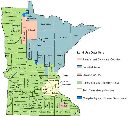
Documentation (an identifier map shows which counties are included in each data set):
- Agricultural and transition areas
- Forested areas
- Twin Cities metropolitan area, 1990
- Clearwater and Beltrami counties
- Camp Ripley and Beltrami Island State Forest
- Documentation for Olmsted County is not available
Clicking on a County name will automatically launch the PDF file.