DEM Hydro-modification Subgroup

A Subgroup of the 3DGeo Hydrogeomorphology Workgroup
Mission and Work Plan
- Mission: The DEM Hydro-modification Subgroup is dedicated to developing the foundation for single, authoritative, digital dam breachline and hDEM datasets for Minnesota utilizing standards and methodology developed through collaboration with breachline subject matter experts.
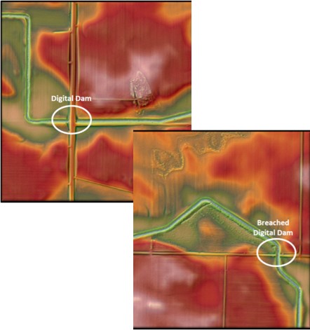
The subgroup has extensive knowledge gained in building their own individual digital dam breachline datasets and hydro-modified digital elevation model (hDEM) raster datasets. Collectively, these datasets have hundreds of thousands of breachlines. The long term goal is to publish these features into one authoritative dataset for use in developing hDEMs that serve public and private business needs associated with hydro-terrain analysis tools (e.g., PTMApp and ACPF), hydrology, and hydraulic modeling of the landscape.
- Factsheet: Summary of the subgroup's mission and work (coming soon)
- Workplan
- Education and Outreach
- Design one-page handout that describes the Subgroup and highlights the successes and future efforts of this collaborative group
- Look for opportunities to connect with hydrography-related committees and workgroups within Minnesota agencies and other states
- Continue collaboration between technical staff and decision makers on hydro-modification and breachline creation
- Finalize and publish standardized breachline attributes
- Develop a standards document for breachlines
- Develop and finalize a breachline attribute geodatabase template
- Develop a methodology and protocol document for hydro-modification
- Methodology and protocol will be based on members' knowledge and experience
- Establish a Digital Dam Breachline QA/QC Project
- Strategize ways to fund the Digital Dam Breachline QA/QC Project
- Develop protocol document to guide QA/QC and assembly of the database for the existing breachlines
- Ensure the subgroup's authoritative database attributes are incorporated into the project
- Serve or provide a spot review of draft data from the project
- Publish the data for public consumption
- Goal Statement: All breachlines will be populated with authoritative database attributes
- Ultimate Goal Statement: A final product capable of producing a Level 3 hydro-modified DEM
- Update and refine the draft centralized authoritative map of current breachline datasets
- Identify documents and other best practices
- Establish an archive in SharePoint of literature that pertains to breachlines and hydro-modification and move products to a public-facing site
- Identify what other states are doing in terms of hydro-modification and breachlines
Accomplishments
- DEM Hydro-modification - An update for 2020 (coming soon)
- Breachline Standardized Attributes
- HDEM Completeness Valuation Maps
Subgroup Membership
Chair
- Rick Moore, Lidar Data Steward, MNIT DNR, 507-389-8810, rick.moore@state.mn.us
Steering Committee Liaison
- Sean Vaughn, Lidar Data Steward, MNIT DNR, 763-284-7223,
sean.vaughn@state.mn.us
Subgroup Members
| Name | Organization | |
| Andrea Bergman | MNIT Department of Natural Resources | andrea.bergman@state.mn.us |
| Matt Drewitz | Board of Water and Soil Resources | matt.drewitz@state.mn.us |
| Chuck Fritz | International Water Institute | charles@iwinst.org |
| Tyler Grupa | Water Resource Center, MN State University, Mankato | tyler.grupa@mnsu.edu |
| Thomas Hollenhorst | US Environmental Protection Agency | hollenhorst.tom@epa.gov |
| Grit May | International Water Institute | grit@iwinst.org |
| Rick Moore | MNIT Department of Natural Resources | rick.moore@state.mn.us |
| Joel Nelson | University of Minnesota | nels1945@umn.edu |
| Sarah Porter | USDA - Agricultural Research Service | sarah.porter@usda.gov |
| Mark Reineke | Widseth Smith and Nolting | mark.reineke@wsn.us.com |
| Christiane Roy | USDA - Natural Resources Conservation Service | christiane.roy@mn.usda.gov |
| Kiah Sagami | Houston Engineering, Inc. | ksagami@houstoneng.com |
| Jamie Schulz | MNIT Department of Natural Resources | jamie.schulz@state.mn.us |
| Sean Vaughn | MNIT Department of Natural Resources | sean.vaughn@state.mn.us |
Meeting Minutes
Resources
Data and Application Resources
- Culvert Inventory Application Suite: The DNR Culvert Inventory Application Suite is comprised of 4 related components for the collection, storage, edit/review and distribution of stream crossings, culverts, bridges, and breach line data. It was developed by the MNDNR GeoSpatial Water Resources Team (GeoWRT) in partnership with DNR MNIT professional services staff. This application is available to DNR staff and external partners (free registration required).
Project Resources
- Hydromodified DEM status map: A story map created by Houston Engineering, Inc. to show the status of DEM hydroconditioning and product development for the PTMApp application (a tool to prioritize, target and measure best management and conservation practices to improve water quality).
Document Resources
Return to 3D Hydromorphology Workgroup page
Return to 3D Geomatics Committee page

