Rivers and Streams Data for Minnesota
Water Resources Home |
Lakes | Rivers & Streams |
Watersheds | Wetlands |
Miscellaneous
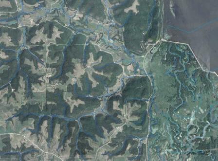 In addition to its lakes, Minnesota's 92,000 miles of rivers and streams are a very important resource. This page references GIS datasets such as the National Hydrography Dataset, and DNR Hydrography streams base layer and derived layers, and the FEMA Floodways database. Links are provided to the DNR/PCA Cooperative Stream Gaging Program, USGS real-time river gage data, and PCA stream water quality assessments.
Categories
Hydrography: GIS and mapping data of rivers and streams, also including stream gage and floodway information
Quality: Both GIS and non-GIS data concerned with river and stream water quality
General: Miscellaneous river and stream data
Hydrography/Bathymetry
| Name | Source* | Geographic Area | Scale | Time Period | Data Type |
| Description | |||||
| National Hydrography Dataset | USGS | Nationwide | 1:24,000 | Current | Vector GIS |
|
The National Hydrography Dataset (NHD) is a national framework database of digital surface water features that are combined into "reaches" and a reach addressing system that provides a way to link water-related data to the surface drainage network. These links also enable the display and analysis of water data in upstream and downstream order. |
|||||
| MnDNR Hydrography: Streams |
DNR |
Statewide | 1:24,000+ | Current | Vector GIS |
| Within the MnDNR Hydrography database, the 1D Stream Routes feature class is the base layer for many derived layers, including: Stream Confluences and Flow Direction, Stream Routes with Stream Types, and Stream Routes with Kittle Numbers and Mile Measures. The Kittle Routes layer contains stream names. For 2D river features, see DNR Hydrography: Lakes and Open Water. | |||||
| Minnesota Trout Streams | DNR Fisheries | Statewide | 1:24,000+ | 2013 | Vector GIS |
|
This layer shows legally designated trout streams and trout stream tributaries as identified in Minnesota Rules Chapter 6264. |
|||||
FEMA Flood Map Modernization
|
FEMA |
In progress | 1:24,000 | Current | Vector GIS |
| A DFIRM is the official digital map of a community on which FEMA has delineated the special flood hazard areas, i.e., the floodplain areas where flood insurance is required for loans and where communities will administer floodplain regulations. Layers include: Base Flood Elevations, Flood Hazard Zones, and Cross Sections. As part of a national 5-year map modernization effort, FEMA floodplain maps are being updated. If available, newer flood elevation data are being used, and newer elevation data (topography) are being used to draw the boundaries of the floodplain. | |||||
|
Statewide Altered Watercourse Project |
MPCA, MnGeo |
Complete | 1:24,000 | Current | Vector GIS |
| Stream channel modification (i.e., straightening of stream channels, removal of oxbows and dredging) is a significant source of habitat destruction in many freshwater ecosystems. MPCA needed a more accurate quantification of the extent of altered stream miles throughout the state to support its water quality assessment program. MPCA and MnGeo developed a methodology to categorize streams as 'natural', 'altered', or 'impounded'. This categorization is applied to all Minnesota streams in the National Hydrography Dataset and is updated periodically (see dataset documentation for details). | |||||
| Buffer Protection Map | DNR | Statewide | Various | Current | Vector GIS, Web Application |
|
These data represent public waters and public ditches that require permanent vegetation buffers or alternative riparian water quality practices. The map helps landowners identify buffer protection requirements, under Minnesota's Buffer Law. |
|||||
| DNR/PCA Cooperative Stream Gaging website | DNR, PCA | Statewide | Various | Current | Web Application |
|
This website provides access to (provisionally) current and historical stream level and quantity data from gage sites maintained through the DNR/PCA Cooperative Stream gaging network. |
|||||
| USGS Real Time Water Data for Minnesota |
USGS |
Statewide | Various | Current | Web Application, Table |
| Website contains web map application of Daily Streamflow Conditions at USGS gages throughout Minnesota as well as links to streamflow, precipitation and ground-water tables. | |||||
|
USGS |
North America | 1:2,000,000 | Various | Vector GIS, Maps | |
| Generalized water data such as 'Streams and Waterbodies'. | |||||
|
USGS |
Upper Mississippi River | Various | Various | Raster and Vector GIS, Maps | |
| The Long Term Resource Monitoring Program at the Upper Midwest Environmental Sciences Center has overseen the collection, processing, and serving of bathymetric data since 1989. | |||||
Quality
| Name | Source* | Geographic Area | Scale | Time Period | Data Type |
| Description | |||||
| Streams and Rivers |
PCA |
Statewide | Various | Current | Text |
| This page provides links to various PCA stream water quality programs and data. | |||||
|
305b
Assessments of Stream
Conditions 2012 Assessed Streams GIS data |
PCA |
Statewide | Various | 2012 | Text, PDF, Web Application, Vector GIS |
| Section 305b of the U.S. Clean Water Act requires states to estimate how well they meet the goals of the Clean Water Act as well as their own water quality standards and to share this information with people involved with watershed management. This webpage contains links to stream water quality assessment reports and interactive maps. | |||||
| Environmental Info Management Systems |
Metropolitan Council |
Twin Cities metro | Various | Current | Spreadsheet and JSON |
| View and download water quality data on lakes, rivers, streams and rain gauges for the region. | |||||
| How's My Waterway? |
EPA |
Nationwide | Various | Current | Web Application |
| Learn the condition of local streams, lakes and other waters quickly and in plain language using a smart phone, tablet or desktop computer. See if local waterways were checked for pollution, what was found, and what is being done. Information source: State water quality monitoring reports. | |||||
General
| Name | Source* | Geographic Area | Scale | Time Period | Data Type |
| Description | |||||
| General Rivers and Streams Information |
DNR |
Statewide | N/A | Current | Text |
| The main DNR webpage that contains links to river and stream facts, FAQs, recreation, stewardship, and studies information. | |||||
| Reach/Watercourse Standard | MnGeo Hydrography Committee | Statewide | N/A | 2006 | Text |
|
This standard has been developed to improve the sharing and exchange of information regarding river reaches and watercourses. It designates the reach and watercourse codes to be used for Minnesota rivers, streams, and ditches in GIS and other data applications. |
|||||
- DNR = Minnesota Department of Natural Resources
- EPA = United States Environmental Protection Agency
- FEMA = Federal Emergency Management Agency
- PCA = Minnesota Pollution Control Agency
- USGS = United States Geological Survey