Spring Aerial Imagery of East-Central Minnesota: April 2010
Spring Imagery Home |
Northeast |
East-Central |
South |
Central and Northwest
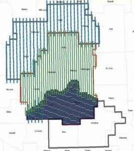
Eleven of thirteen East-Central Minnesota counties were flown Spring
2010 for high-resolution 4-band digital imagery from which stereo and ortho-rectified data products will be produced.
Surdex Corporation began flying on April 7. Due to early spring
weather, flights were curtailed after April 18. All areas
postponed from 2010 were acquired Spring 2011:
Goodhue and Rice counties; downtown St. Paul (reflown to minimize
building lean); and stereo imagery at 0.5-meter resolution for Dakota,
Goodhue, Rice and Scott counties.
- Project brochure (2 p., 570K, PDF)
- Mosaic image posters (7-8 MB, JPG)
- Documentation:
0.5-meter resolution and
1-foot resolution
and horizontal accuracy report
View Imagery
The 2010 imagery is
available via
MnGeo's WMS service.
Data Resolution
- Wright, Sherburne, Isanti and Chisago counties were collected at 20-inch resolution, the nominal resolution specified by the DNR and Met Council.
- Anoka, Carver, Hennepin, Ramsey and Washington counties were collected at 1-foot resolution thanks to a grant from the NGA, which requires that resolution to support its 133 Urban Areas Program.
- Dakota and Scott counties took advantage of this regional data collection opportunity to buy up to a 6-inch resolution.
- Rice and Goodhue counties, which were scheduled for 20-inch resolution coverage, were not collected so were flown in Spring 2011. Rice County bought-up to 1-foot resolution.
- The state also exercised an unsolicited option proposed by the
vendor for increased horizontal accuracy.
Credits
The project is being funded by the Minnesota Department of
Natural Resources, the Metropolitan Council, the National
Geospatial-Intelligence Agency (NGA) and the Metropolitan Mosquito Control
District. MnGeo is managing federal and vendor contracts and interagency
agreements.
Project Contacts
| MnGeo gisinfo.mngeo@state.mn.us |
Steve Kloiber, Project Coordinator National Wetlands Inventory Update Minnesota Department of Natural Resources 651-259-5164 steve.kloiber@state.mn.us |
Return to MnGeo's first-stop Aerial Photography page


