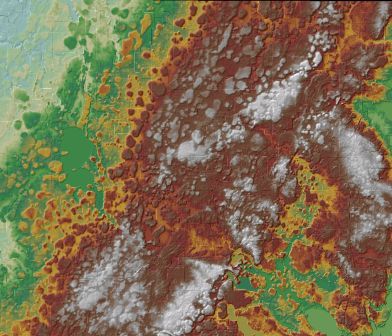
Digital Elevation Committee
Final report:
The committee was sunset 3/22/17. A new
3D Geomatics Committee has been formed to
carry on relevant parts of its work.
The committee worked to promote the creation of statewide digital elevation data that is consistently accurate and available to the public, and advises MnGeo.
The Digital Elevation Committee was formed under the auspices of the former Minnesota Governor's Council on Geographic Information on September 20, 2006, continuing the work of Minnesota's Digital Elevation Working Group which functioned for years on a mission to improve Minnesota's elevation data. The LiDAR Research and Education Subcommittee formed in August 2010.
Important links
- Minnesota Elevation Mapping
Project
LiDAR data collection project, 2010-2013- Project receives
Governor's
Geospatial Commendation Award
- Project receives
Governor's
Geospatial Commendation Award
- First-stop information page to find Minnesota elevation data and maps
- LiDAR Research and Education Subcommittee
Work plan
Strategies:
- Assist in the development of partnerships that support data collection projects
- Deliver technical standards and information to partners to ensure coordinated data collection
- Support data services that host data resources and deliver them economically
Goals:
Deliver
- Maintain the committee's website containing all critical documents, white papers, guidelines, policies and best practices to meet a statewide elevation data goal
- Advise the work team that is overseeing the Minnesota Elevation Mapping Project, especially in the areas of critical technical specifications, data collection costs, and guidelines to guide budgets
- Compile and report on uses of LiDAR and other elevation data in Minnesota
Support
- Work with DNR and others to determine requirements to serve very large elevation databases
- Establish architecture to optimize data access
- Establish governance policies that assign roles and responsibilities for data import, maintenance and access applying that architecture
- Work with the LiDAR Research and Education Subcommittee to review issues relating to standards, user needs for education, and similar topics.
Committee activity reports and meeting minutes
Publications and links
- LIDAR project: Red River of the North Basin, Phase 1: Project information and sample documents.
-
Reality Check: Processing LiDAR data by Tim Loesch,
Minnesota Department of Natural Resources: This presentation from
the 2006 Minnesota GIS/LIS conference reviews the steps used to process
LIDAR data from the Red River watershed and covers general lessons
learned. Available in:
- PowerPoint slide format (14 MB)
- PDF format (7 MB)
- Red River Basin Mapping Initiative letter of support (February 28, 2007) from the Governor's Council on Geographic Information for a proposed International Water Institute project to collect high-resolution elevation data for the U.S. portion of the Red River Basin.
- Developing a High Resolution DEM and Floodplain Mapping Program: June 2002 white paper from DNR - Division of Waters (715K, PDF).
Return to MnGAC committee page

