Telecommunication Infrastructure Information for Minnesota
Use this site to find GIS data, maps and statistics that show information about Minnesota's telecommunications infrastructure.
Service areas and area codes
-
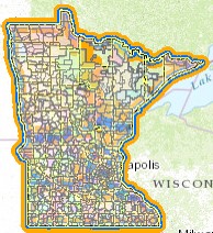
Minnesota GIS data and online map: Boundaries of telephone exchange service areas, area codes, LATA zones and counties
-
Area code maps for the United States and Canada, from the North American Numbering Plan Administrator
Broadband / Fiber optic
Most fiber optic information is proprietary and is not publicly available.
Transmission towers and service areas
See the Federal Communications Commission's Data webpage for FCC licensing data, regulated towers and market area
boundaries, including datasets for cellphone towers and service areas, land mobile station locations, AM, FM, microwave, pager and TV communication towers, and antenna structure registrations.
Other telecom map and data resources
- Minnesota Department of Commerce: Find a phone service provider
- Minnesota Public Utilities Commission, Find a landline company
- Glossary of Telecom Terms: Compiled by Verizon.
- North American Numbering Plan Administrator (NANPA): information about telephone number assignment. For example, find out which prefixes, the first three digits after the area code, are assigned or are available for assignment in each geographic area code (see their website guide).
- To find telecommunications information for other states, check the list of state telephone associations maintained by the Minnesota Telecom Alliance.
Return to MnGeo's main Utilities and Telecommunication first-stop information page

