Lidar Elevation Data for Minnesota: 2008-2012
Elevation Home | Lidar |
Raster Data/Shaded Relief |
Contour/Point Data |
Topo Maps
| General Info
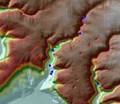
Lidar ("Light detection and ranging")
is an active remote sensing technology that uses laser light to detect and measure
surface features on the earth. Lidar-derived high-resolution elevation
data products are available for all of Minnesota.
Featured
- Planning for Updated Lidar Acquisition
- Draft Minnesota State Lidar Plan
- Phase 1: NE Forested Lidar Acquisition Area
- NE Area Update, July 2020
- Draft Story Map about the draft plan (if does not display in IE, use another browser)
- USGS 3DEP Lidar Areas of Interest - SeaSketch: Express your interests and needs for lidar
-
MnTOPO: A web application for viewing, printing and
downloading high-resolution elevation data for Minnesota collected using lidar
technology
- View terrain data and contour lines, choose from several basemaps, view flight lines and metadata
- Create, save and print a map
- Find the elevation of a point and draw elevation profiles
- Download lidar data by drawing a polygon around your area of interest
- Select only the layers you need
- Choose from several formats
- Tiles in most formats will be mosaicked for the download
- Tip sheet:
If you get a loading error with MnTOPO, it's likely caused by a
"Compatibility View" setting in Internet Explorer browser v11 which is
easily fixed.
- Hydrographic Position
Index Technical Report: Combining lidar-derived DEM
analysis, raster classification and color symbology for pseudo-3D terrain
visualization to enhance hydrography interpretation on the DEM landscape
Data Download
- Folder names and organization have been changing, so some of the paths given in the readme files need updating. The readmes will be updated once the names and organization stabilize - please let us know ( gisinfo.mngeo@state.mn.us ) if you are having trouble finding anything.
- Contents and
filesizes of lidar geodatabases:
- This table summarizes the derived products found in each county geodatabase since not all counties are identical (e.g., not all counties have a building footprint layer)
- Filesizes for the county geodatabases are included since the filesizes do not display on the FTP site.
- If you haven't used this site or lidar data before, see the help files.
- Download problems:
- Many of the data files are huge and should be downloaded with an FTP client rather than a browser. FileZilla works well.
- No username or password is needed to download from MnGeo's FTP site. For unknown reasons, sometimes the Internet Explorer (IE) browser may prompt you for a user name and password. If this happens, try using another browser such as Firefox or Chrome, or possibly a different version of IE.
- Unzipping problems: Some older unzip programs cannot handle the extended zip format which is used to compress these very large files. They vastly overestimate the filespace needed to unzip the files. We recommend using 7-zip on Windows and the standard zip/unzip programs on other operating systems.
- Flight lines and dates of acquisition (where available):
- Problem with some LAS files in Stearns, Sherburne and Hennepin
counties, near Wright Co. border
- The following files are missing some data (see graphic with missing areas outlined in red): 3542-22-07, 3526-22-59, 3542-25-16, 3526-19-62, 3542-26-14, 5158-08-11, 3542-20-03, 3526-22-60, 3526-22-57, 3526-19-64, 3542-21-05, 3542-20-02, 3542-26-13, 3542-24-16, 3542-19-01, 3542-28-12, 3542-28-11, 3526-19-63, 3542-30-09, 3526-22-56, 3526-22-58, 3526-21-61. If they can be fixed, replacements will be published.
Help
|
ArcGIS 10.1 Toolbox (MnDNR)
Streamlines downloading and merging lidar data associated with a polygon of
interest from within ArcGIS software
Requires ArcGIS 10.1 Service Pack
1 or above.
Hillshade layer (lidar-derived, black-and-white image) on MnGeo's WMS image service. Documentation
Areas Covered:
- Arrowhead:
- Fall 2012, Duluth Area, taken after the spring 2012 flood.
- Maps showing area covered
- Documentation
- This data replaces the corresponding tiles in the Spring 2011
Arrowhead collect EXCEPT in the "arrowhead" project folder, the "previous"
folders in the q250k folders, and in the county mosaics. Data is
available for download from the
"duluth_fall_2012" projects folder, the
q250k
folders, and the
county folders
(the tiles but not the county mosaics).
- Spring 2011,
Carlton, Cook, Lake and St. Louis counties, part of Itasca County, and
Voyageurs National Park in Koochiching County.
- Map showing block boundaries
- Documentation
- Data is available on the FTP site in different places, depending on
whether or not it has been replaced by the 2012 Duluth Area collect:
- If it has NOT been replaced by the 2012 Duluth Area collect, 2011 data is available in the "arrowhead" projects folder, the q250k folders and the county folders.
- If it HAS been replaced by the Duluth Area collect, 2011 data is still
available in the
"arrowhead" projects folder, in the "previous" folder in the
q250k
folders and in the county mosaic (but not the tiles) in the
county folder.
- Fall 2012, Duluth Area, taken after the spring 2012 flood.
- Central Lakes: Collected Spring 2012. The data covers
Aitkin, Cass, Hubbard, Itasca, Todd and Wadena counties and a portion of
Koochiching County.
- Documentation
- Block boundaries map
- Data is available for
download from the
projects folder, the
county folder and the
q250k
folder.
- Twin Cities Metro: Collected Spring and Fall 2011. The data
cover Anoka, Benton, Carver, Dakota, Goodhue, Hennepin, Isanti, Kanabec,
Meeker, Mille Lacs, Morrison,
Ramsey, Scott, Sherburne
and Washington counties.
- Documentation
- Data is available on the FTP site both by county (in the county folder) and by block (in the projects folder). See map showing block boundaries.
- Tile naming for the Dakota Block, Metro Block and Maple Grove Block: Since the
point density of these collects is higher than the other blocks (2
points/square meter for the Dakota Block, and 8 points/square meter for
the Metro and Maple Grove blocks), the vendor tiled the las files further, breaking each standard
tile into 16 additional tiles. They are simply appended an A, B, C, or D
starting in the upper left and proceeding in a clockwise direction. A
sample image, taken from the
tile index map that is on the site, shows a single tile with the
sub-block lettering scheme. A sample tile name would be:
4243-02-30_a_a.laz. Also, there is a tiling scheme feature class in the
elevation_data file geodatabase.
- Red River Basin (Spring 2008-Spring 2010)
- 19 1/2 Minnesota counties available: Becker, Beltrami, Big Stone, Clay, Clearwater, Grant, Kittson, Koochiching (northern part - see map for area covered), Lake of the Woods, Mahnomen, Marshall, Norman, Otter Tail, Pennington, Polk, Red Lake, Roseau, Stevens, Traverse and Wilkin counties.
- Documentation
- Data is in the
county
folder of the FTP site.
- Derived
Products: Overview of derived products and those in development,
7/15/13 (PDF)
- Overview article
- Documentation
- 8,800 square
miles in nine counties: Dodge, Fillmore, Freeborn, Houston,
Mower, Olmsted, Steele, Wabasha and Winona County.
- 17,260 square miles in 25 counties: Brown, Chippewa, Cottonwood, Douglas, Faribault, Jackson, Kandiyohi, Lac qui Parle, Le Sueur, Lincoln, Lyon, Martin, Murray, Nicollet, Nobles, Pipestone, Pope, Redwood, Renville, Rock, Sibley, Swift, Waseca, Watonwan, Yellow Medicine.
- Documentation
- Blue Earth 2012 (2005 also available)
- Independent county projects:
Chisago,
Crow
Wing, McLeod,
Pine,
Rice,
Stearns, and
Wright
These counties are available for general distribution via agreements between these counties and the State of Minnesota and/or the U.S. Geological Survey. Pine County is available by agreement with the Natural Resources Conservation Service.
- Lake Superior Bathymetry: Hydrographic and topographic data collected along the Lake Superior coast of Minnesota, Wisconsin and Michigan for NOAA. Data extends offshore from the shoreline to extinction depth or 1 km, whichever is closer, and onshore from the shoreline to 30 meters.
- Lake Shady: A reservoir on the Zumbro River in Olmsted County.
- Mille Lacs Kathio State Park: in Mille Lacs County; see park description; data from an independent project centered on the park.
- Minnehaha Creek: in Hennepin County, data from a U.S. Army Corps of Engineers project.
- Minnesota River Basin, South Dakota portion: documentation Data is in UTM Zone 14 coordinates
- Red River Basin Block I: Covers Lake of the Woods and Roseau counties, eastern Marshall County and northern portions of Beltrami and Pennington counties; see a graphic showing location of Block I.
- Seven Mile Creek: in Nicollet County
- Twin Cities Metro Block A_C: 32 tiles (10/19/12)
- Arrowhead Block 4: tile 2742-02-53 (12/11/12)
- Morrison and Cook county tiles (3/7/13)
- Carver County building footprints (3/11/13)
Education and Training

- Training Modules,
Webinars and Tools
- Conservation Applications of Lidar (University of Minnesota)
Six training modules on conservation applications of lidar. Each module was taught as a half- or full-day workshop at locations around Minnesota.
- Webinars:
- Using Lidar data to Advance Local Conservation Work: An overview for managing administrators and non-technical staff, Tim Loesch, MN Dept. of Natural Resources, recorded June 12, 2013
- Using Lidar-based Terrain Analysis Products,
recorded May 22, 2013
- Hydrology and Terrain Analysis Tools for Using Lidar Data (NRCS)
Free python-based ArcGIS tools- Webinars
- Hydrology and Terrain Analysis Tools, introduction to the tools, recorded February 6, 2013
- Lidar-Based Design of Water and Sediment Control Basins: March 19, 2013 (only the introductory slides are online since the original webinar had technical problems)
-
Download the tools: as one zip file
(updated: v. 1.1.14, 1/26/18)
- Webinars
- Conservation Applications of Lidar (University of Minnesota)
-
Glossary of Lidar-related Terms
- 2013 Mn GIS/LIS Conference Lidar Presentations
- Accessing and Viewing Minnesota Lidar Data On-line, Tim Loesch, MnDNR (25 slides, 5MB, PPTX)
- Help Me Use Lidar Data!,
Nancy Rader, MnGeo (16 slides, 18MB, PPTX)
- Handout (PDF)
- Handout (PDF)
-
Lidar and DEM Tips and Tricks
(9 MB,
PPT)
Tim Loesch, MnDNR, 2011
Tips to help effectively display Lidar and DEM data.
-
Accessing and Using Minnesota Lidar Data Packets
(2.4 gigabytes, zipfile)
Tim Loesch and Shelly Sentyrz, MnDNR, 10/5/11
Powerpoint slides, exercise materials and data from a GIS/LIS Consortium workshop.-
Slides only
(29 MB, zipfile)
-
Slides only
(29 MB, zipfile)
- Esri Training: Search
on "Lidar" in Esri's
Training Catalog
- The
3DGeo Education Workgroup identifies education and training needs.
Programs

- Minnesota Elevation Mapping Project
A State of Minnesota Legacy Amendment project to complete lidar coverage of the state.
- 3DEP
The primary goal of 3DEP is to systematically collect enhanced elevation data over the United States and the U.S. territories. -
Red River Basin Mapping Initiative
The goal of the Red River Basin Mapping Initiative was to develop a high resolution DEM for the Red River of the North Basin south of the U.S./Canada border using lidar.
Uses of Lidar in Minnesota
Examples illustrating how lidar data is already being used in Minnesota:
- Protecting water quality
- Minnesota Solar Suitability Analysis project, which used Minnesota's statewide lidar data, wins Esri Climate Resilience App Challenge award